
Pacific Storm Patterns Are Shifting and Los Angeles Weather Arrives Out of Nowhere
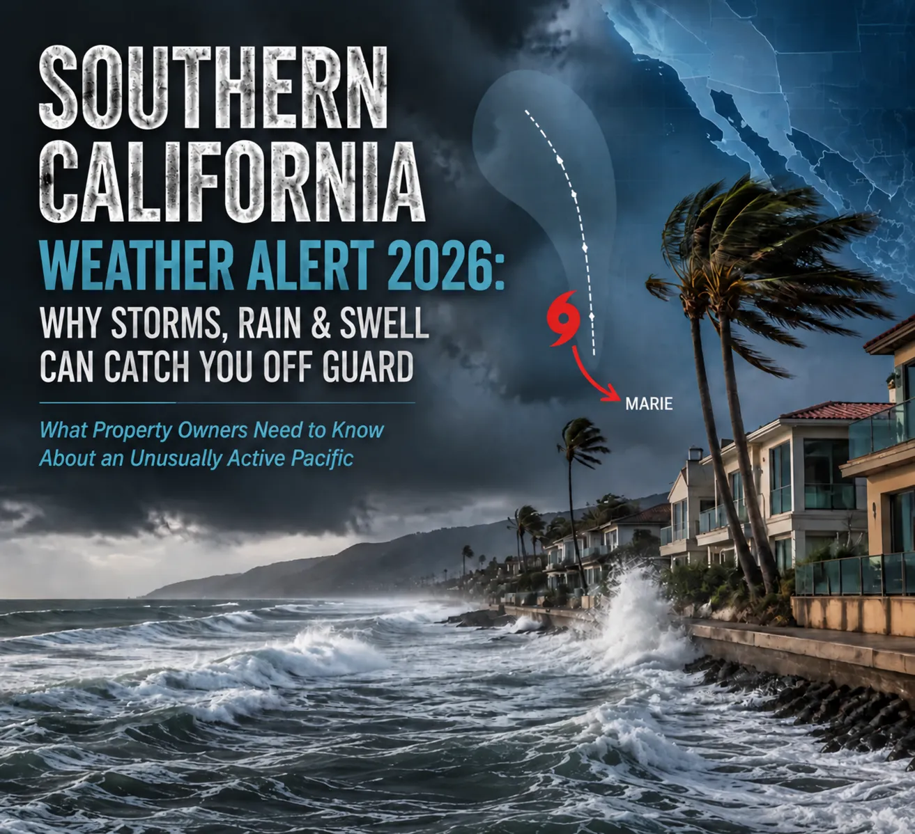

CURRENT SYSTEM UPDATE – September 2, 2026: Tropical Storm Marie is active in the eastern Pacific. The National Hurricane Center track keeps the center hundreds of miles offshore, with dangerous surf as the high-confidence hazard for Southern California and rain as a possibility. Details in the sections below.
The eastern and central Pacific is unusually active, and Southern California property owners are seeing weather patterns, fueled by a looming SUPER EL NIÑO, that can be difficult to predict. Three named storms were active at once in early September 2026, while ocean temperatures off the coast reached unusually high levels. The NOAA Climate Prediction Center has also placed the odds of a very strong El Niño this fall and winter above 90 percent.
For Los Angeles property owners, the concern is not simply whether a hurricane makes landfall. Rain, coastal swell, moisture surges, and wind-driven water can all expose weaknesses that have been developing in a building envelope for years.
I have spent more than thirty years investigating water intrusion on the Westside, and some of the most surprising calls are from owners who see water inside their homes even when there was no major storm directly overhead. That pattern is why storm damage restoration work so often traces back to an envelope problem that predates the weather by years.
Why Does Southern California Weather Arrive With So Little Warning?
Forecast models stop agreeing with each other about three days out, which leaves property owners without a reliable signal until the weather is nearly on top of them.
The spread is not small. For the system active in early September 2026, NWS Los Angeles and Oxnard published ensemble guidance showing 5 to 10 percent of members producing 2 or more inches of rain while 20 to 30 percent of members left Southern California completely dry. One family of models pushed the system north through the region. Another turned it west, where it never approached California at all.
Both outcomes stayed on the table until the last few days. A property owner watching the forecast during that window sees a range running from nothing at all to a soaking, which is not information anyone can act on. The practical result is that preparation has to happen before the forecast clarifies, not after.
Swell behaves differently and gets even less attention. Waves generated by a storm 800 miles offshore reach the coast whether or not that storm ever threatens land, and they arrive on a schedule set by the ocean rather than by anything visible in the sky. Owners in low-lying coastal areas often experience the resulting water intrusion as completely unexplained.
What Is Actually Changing in the Pacific?
El Nino is strengthening, and the Climate Prediction Center has an El Nino Advisory in effect with a greater than 90 percent chance of a very strong event through Northern Hemisphere fall and winter 2026 into 2027. There is a 69 percent chance that October through December 2026 ranks as a historic event, exceeding every El Nino on record back to 1950, measured at +2.5 degrees Celsius or higher on the three-month RONI value.
That background does two things. It warms the water that tropical systems feed on, and it shifts the steering pattern that normally sends those systems away from California. More storms form, and more of them send moisture north.
The activity is already visible. Three named storms were running simultaneously in the eastern and central Pacific in early September 2026. Nearshore water temperatures behaved erratically through August, with readings swinging more than 14 degrees at a single location inside four days.
The longer outlook matters more than any single system. We covered it in our breakdown of a possible Super El Nino in California, and the takeaway for property owners is a wetter, longer storm season placing more cumulative load on building envelopes that were detailed for a drier pattern.
How a Typical Eastern Pacific System Tracks
Marie is a tropical storm in the eastern Pacific, located roughly 400 miles southwest of Manzanillo, Mexico as of the National Hurricane Center advisory issued Tuesday, September 1, 2026.
The 8:00 a.m. MST advisory placed the center at 15.0N, 108.7W, moving northwest at 9 miles per hour with maximum sustained winds of 45 miles per hour and a minimum central pressure of 1002 millibars. Tropical-storm-force winds extended outward as far as 205 miles from the center. No coastal watches or warnings were in effect for any land area.
Forecasters expect Marie to reach hurricane strength by Wednesday night, then turn west-northwest on Thursday. The projected track has the storm near 20.3N, 117.0W by Friday at roughly 85 knots. Saturday and Sunday positions place the center near 22.3N, 122.0W, which NWS San Diego describes as about 775 miles southwest of San Diego.
That distance matters. A storm center 775 miles offshore produces swell and possibly some high-level moisture over Southern California. It does not produce a Long Beach landfall.
Does This Mean a Hurricane Will Hit Los Angeles?
A direct hurricane landfall remains the least likely outcome, and that is the wrong thing to prepare for. The realistic hazards are rain, moisture surges, swell and tidal intrusion, all of which reach Los Angeles far more often than any storm center does.
Hazard rankings from the Los Angeles forecast office tell the clearest story. Large waves and strong rip currents carry a high chance. Coastal flooding on south-facing shores carries a moderate chance. Gusty offshore winds, elevated fire risk and downed trees all carry a low chance. Widespread moderate to heavy rain and flooding also carries a low chance.
Viral forecasts claiming near-certainty of a historic landfall are not National Weather Service products. Some come from surf-report accounts and social video series with no forecasting mandate. The underlying science in those posts is often partly correct while the confidence level attached to it is invented.
The Three Defenses That Are Weakening
Southern California has been protected by three natural barriers, and current Pacific conditions are eroding all three at the same time.
Ocean Temperature
Hurricanes need sea surface temperatures around 80 degrees Fahrenheit, or 26.5 degrees Celsius, to maintain intensity. The California Current and coastal upwelling have historically held water off Southern California between 55 and 75 degrees, which starves an approaching storm of the heat it runs on. A marine heatwave has been pushing that ceiling upward.
August 2026 readings showed how variable the nearshore picture can be. Surfline reported San Clemente at 80 degrees on August 23, then back down to 66 degrees three days later on August 26. NOAA buoy 46025 measured roughly 73 degrees around August 31, with buoy 46047 near 70 degrees. The National Hurricane Center still expects Marie to encounter cooler water and drier air as it moves north and west this weekend.
Steering Winds
Trade winds and the subtropical ridge push eastern Pacific systems west toward Hawaii or into open ocean, and northward turns toward California run against that pattern. El Nino shifts the jet stream and weakens the reliability of that steering, which is why the model disagreement described above has become common rather than exceptional.
Distance and Decay
Systems that survive the turn north still have to cross hundreds of miles of cool water or traverse the Baja peninsula, and both erode intensity quickly. This defense remains the strongest of the three. What it does not stop is moisture, swell and rain, which reach the coast long after the wind field has collapsed.
What Happened in 1939, and Why It Keeps Getting Cited
The September 1939 storm made landfall near San Pedro as a tropical storm on September 25, making it the only tropical cyclone to make landfall in California during the twentieth century.
The system formed on September 15 and reached hurricane strength before weakening on approach. A ship reported Force 11 winds and a pressure of 971 millibars. The National Hurricane Center attributes 45 deaths to the storm, with other tallies reaching 93 when deaths at sea are counted. Damage totaled roughly $2 million in 1939 dollars.
Rainfall was the real story for property owners. Downtown Los Angeles recorded about 5.6 inches, a September record at the time, while Mount Wilson took 11.60 inches. The Los Angeles River flooded and homes washed out along the coast from Malibu to Huntington Beach. Beachgoers were caught without warning because no local forecast office existed.
That gap closed directly because of the storm. The Weather Bureau opened a Southern California forecast office in February 1940. September 1939 also brought four separate tropical cyclones into California weather, which shows that tropical moisture reaching the state is common even when landfall is not.
Other Storms That Reached California
California experiences some effect from tropical cyclones roughly once a year on average, almost always through rain, flooding, or surf. Several historical storms show how those effects can reach the state without a direct landfall.
- 1858 San Diego Hurricane: Produced hurricane-force winds near San Diego and remains the only known hurricane-force event on the United States West Coast.
- Kathleen, 1976: Delivered extreme rainfall that buried the town of Ocotillo in mud, demonstrating how tropical moisture can create serious inland flooding.
- Nora, 1997: Crossed into the Southwest and knocked out power across parts of the Los Angeles area.
- Kay, 2022: Brought heavy rain and very strong mountain winds to Southern California.
- Hilary, 2023: Dropped more than 13 inches of rain in some locations and triggered the first tropical storm watches and warnings ever issued for California. The NWS Los Angeles post-tropical cyclone report documents wind, rainfall, and water-level observations from the event.
- 2025 tropical remnants: Moisture from Mario, Narda, Priscilla, and Raymond produced rain, surf, and localized flooding without any of the systems making landfall.
The pattern holds across more than a century. California’s tropical threat usually arrives as water from above or water from the ocean, not as a hurricane making landfall.
What the Labor Day Weekend Forecast Actually Says
Labor Day 2026 falls on Monday, September 7, and the holiday forecast centers on the ocean.
Shower chances begin Saturday and increase Sunday into Monday night, with a slight chance of thunderstorms Saturday through Monday. Brief heavier bursts are possible where storms develop. Warmer and drier weather is likely returning Tuesday.
The surf outlook carries far more confidence. A building south-southeast swell is expected Sunday into Monday night, with High Surf Advisories likely and evening tides running around 6.5 to 7.0 feet. That combination raises the chance of at least minor coastal flooding and beach erosion. Forecasters have called out Catalina including Avalon, the stretch from Long Beach to Cabrillo Beach, Malibu and Point Mugu. Those locations describe where the swell lands.
Conditions ahead of the weekend stay quiet, with below-normal temperatures and marine layer cloud, plus a Wind Advisory for the western Santa Ynez range.
How Sudden Tropical Moisture Damages Los Angeles Buildings
Tropical rain damages westside buildings differently than winter rain because of two factors, timing and direction.
Timing works against the building. Tropical moisture arrives after months of dry-season deterioration, when sealant joints have contracted and cracked under sustained heat, and when expansive clay soil has pulled away from foundation walls. Winter rain arrives after the same soil has already begun to swell shut.
Direction works against the assembly. Wind-driven rain travels horizontally and upward, penetrating details that shed vertical rainfall without any issue at all. I have inspected walls in Santa Monica and Venice that performed perfectly through twenty years of ordinary storms. Those same walls leaked during their first sustained wind-driven event. Our piece on how atmospheric rivers damage stucco and foundations covers the mechanism in more depth.
Much of the building stock in Brentwood, Bel Air and West Los Angeles compounds both problems. Properties built between the 1950s and 1980s frequently still carry original building paper, aged sealant at penetrations and low-slope roofing at or past its service life.
Stucco and Exterior Walls
Stucco fails at predictable points during wind-driven rain. Hairline cracking at the corners of window and door openings, failed sealant at penetrations, and weep screed buried by added hardscape or landscaping all allow water into the wall cavity.
Water that enters a stucco cavity travels laterally along the drainage plane before it appears inside. Interior staining often shows up several feet from the actual entry point, which is why guessing at the source leads to repeated repairs. Properly applied stucco waterproofing addresses the cladding as a system, which patching individual cracks cannot do.
Roofs, Parapets and Drainage
Low-slope roofing appears throughout westside commercial buildings and much of the mid-century residential stock. Scuppers and roof drains fill with months of accumulated dry-season debris, then pond water during the first meaningful rain of the season.
Ponding accelerates membrane failure and loads parapet flashing beyond what it was detailed to handle. Flashing at parapets, penetrations and roof edges is the single most common failure point I find during post-storm investigations. Roof waterproofing on these assemblies has to start with drainage and terminations before any coating goes down.
Windows, Doors and Balconies
Missing sill pans and failed head flashing allow wind-driven rain past window and door assemblies that handle normal rainfall without trouble. Older installations across the westside often lack sill pans entirely.
Balconies and decks add another vulnerability. Deck coatings wear through at traffic paths and at the transition to the building wall, letting water into the framing below. Balcony leaks frequently show up as ceiling staining in the room underneath, which is where most owners first notice the problem.
Foundations and Crawl Spaces
Negative grade slope directs water toward the foundation, and hydrostatic pressure pushes that water through foundation walls and slab joints. Clay soil holds water against foundations long after the rain stops.
Crawl spaces collect and hold moisture that never fully evaporates, particularly where vents have been blocked or where a vapor barrier was never installed. Saturated crawl spaces feed moisture upward into framing and flooring for weeks.
Rain is not the only water that reaches a foundation during a tropical system. Large swell arriving on top of above-normal tides raises the water table in low-lying coastal ground, and that rise does not need a single drop of rain to happen. Evening tides in the 6.5 to 7.0 foot range combined with a strong south swell push saturated ground inland of the beach itself.
Venice sits low and flat with a shallow water table, so properties there see seepage at slab edges, through cold joints and up through crawl space soil during exactly these conditions. Malibu adds a second mechanism, where hillside runoff meets elevated tidal levels at the base of the slope and water has nowhere to drain. Owners frequently read this as a plumbing failure because it appears in dry weather.
The distinction matters for repair. Seepage driven by tide and swell recurs on a lunar schedule rather than a storm schedule, so a fix aimed only at rainfall will keep failing. Correcting it means addressing the below-grade drainage plane and the crawl space envelope together.
What Should You Check Before the Rain Arrives?
A few checks before the rain arrives can reduce the risk of avoidable water intrusion. Focus first on drainage, grading, and the building envelope:
- Clear drainage: Remove debris from roof drains, scuppers, and gutters. Dry-season buildup can contribute to ponding when the first heavy rain arrives.
- Check the grade: Confirm that the ground slopes away from the building so water moves away from the structure rather than collecting against it.
- Inspect sealant joints: Check windows, doors, and exterior penetrations for separated or deteriorated sealant that could allow water to enter.
- Look for stucco cracks: Pay particular attention to cracks around the corners of windows, doors, and other openings.
- Document existing conditions: Photograph visible damage or problem areas for your records and potential insurance purposes.
These steps can reduce risk, but they do not correct a known building-envelope failure. Our full emergency waterproofing checklist walks through the complete sequence heading into a wet season.
What Are the Warning Signs of Water Intrusion After a Storm?
Some signs of water intrusion appear immediately after a storm, while others can take days to surface. The most common include:
- Ceiling and wall staining: Discoloration at ceiling and wall intersections can indicate water that traveled through the building assembly before reaching the finished surface.
- Bubbling paint: Paint bubbling below window openings can point to moisture entering around the window or through the surrounding wall assembly.
- Musty odors: A musty smell in enclosed spaces can indicate trapped moisture that has not fully dried.
- Efflorescence: White mineral deposits on masonry or concrete mark areas where water has moved through the material over time.
- Warped baseboards or separated flooring: These changes can indicate moisture that entered during the storm and remained in the building materials.
- Damp insulation or crawl spaces: Persistent moisture in concealed areas can signal water intrusion that is not visible from the living space.
Water rarely appears where it enters. It follows the path of least resistance and often reaches a lower point before becoming visible. Interior evidence can also appear days after the rain stops, as saturated materials release moisture into finished surfaces.
Our guide to building envelope failure signs covers what each symptom typically indicates about the source.
How Quickly Does Mold Become a Problem After a Storm?
Mold growth can begin within 24 to 48 hours in saturated materials held at the right temperature and humidity, and warm September conditions on the westside fall well inside that range.
Concealed saturation drives the timeline. Water trapped in wall cavities, behind cabinetry or inside insulation dries far more slowly than visible surfaces, so a wall that feels dry to the touch may still hold enough moisture to support growth. Documented moisture content readings taken across the affected area give a reliable answer where touch does not. Our article on how fast mold grows after water damage breaks down the full timeline.
My team performs mold inspection and remediation. Laboratory testing and air sampling fall outside our scope, and property owners needing that work should engage an independent testing firm.
How We Approach Storm-Related Water Intrusion
Absolute Maintenance & Consulting specializes in exterior water intrusion investigation and building envelope repair. We work on the parts of a building that keep weather out, which separates what we do from plumbing repair and from general contracting.
I founded the company and have spent more than three decades on Los Angeles buildings specifically, holding IICRC certification #70018676 and MICRO certification under CSLB License #998184. That local focus matters because clay soil behavior, mid-century construction detailing and the stucco assemblies particular to this region drive most of what I find on site.
Every investigation starts with a building envelope inspection using thermal imaging and moisture mapping to locate saturation. ASTM E1105 spray rack testing then reproduces the leak under controlled conditions, which confirms the entry point before any repair begins. Structural drying addresses the damage, then envelope repair corrects the failure so the same storm does not produce the same leak next season.
We document conditions throughout the inspection for insurance and repair planning and work on residential, multi-unit, and commercial properties. Residential mold inspections start at $375, while residential building envelope inspections start at $450. Multi-unit inspections start at $875 for properties with 4 to 8 units. Crawl space encapsulation assessments start at $450, with full encapsulation ranging from $7 to $14 per square foot. When we perform the repair, the full inspection cost is credited toward that work. Final pricing depends on the property and the scope confirmed during the inspection.
We serve Beverly Hills, Culver City, Santa Monica, Venice, Pacific Palisades, Brentwood, Bel Air and West Los Angeles.
Frequently Asked Questions
Is Pacific storm activity actually increasing?
Yes. The Climate Prediction Center has an El Nino Advisory in effect with a greater than 90 percent chance of a very strong event through fall and winter 2026 into 2027, and a 69 percent chance that October through December ranks as historic against every event back to 1950. Warmer water and shifted steering both increase the number of systems sending moisture toward California.
What is the biggest actual risk to Los Angeles property from these systems?
The ocean, not the wind. Large swell arriving on top of above-normal tides drives coastal flooding and raises the water table in low-lying ground, producing foundation and crawl space seepage with no rain falling at all. Forecasters carry their highest confidence on this hazard, and it affects the coastline running past Venice and Pacific Palisades.
Has a hurricane ever hit California?
The 1858 San Diego hurricane produced hurricane-force winds near San Diego and stands as the only known event of that strength on the United States West Coast. The September 1939 storm reached San Pedro as a tropical storm, making it the only twentieth-century landfall in California. Both remain exceptional across nearly two centuries of record.
Why does my stucco leak during some storms and not others?
Wind direction explains most of it. Vertical rainfall sheds off stucco without penetrating, while wind-driven rain travels horizontally and forces water into hairline cracks, failed sealant joints and buried weep screed. A wall that performs well through ordinary storms can leak during its first sustained wind-driven event of the season.
How soon after a storm should I have water intrusion inspected?
Within a few days. Mold growth can begin in saturated materials within 24 to 48 hours, and concealed moisture inside wall cavities dries far more slowly than visible surfaces. Early inspection with thermal imaging and moisture mapping documents the full extent while conditions are still readable and before secondary damage develops.
Does homeowners insurance cover storm-related water intrusion?
Coverage typically depends on one distinction, sudden and accidental damage versus gradual deterioration. Storm-driven intrusion through a maintained envelope stands a better chance than damage traced to long-neglected sealant or roofing. Photographic documentation of pre-storm conditions and a professional assessment both strengthen a claim considerably.
Ready to schedule an inspection? Absolute Maintenance & Consulting serves Beverly Hills, Culver City, Santa Monica, Venice, Pacific Palisades, Brentwood, Bel Air and West Los Angeles from our office at 3520 Overland Ave. #A29, Los Angeles, CA 90034. Call (310) 678-4345 or email in**@************ir.com with photos of the affected area for a preliminary assessment. If we perform the repair, your inspection cost goes toward it.
About the Author
 Cameron Figgins
Cameron Figgins is the founder of Absolute Maintenance & Consulting. With over 30 years of hands-on industry experience, he specializes in identifying complex water intrusion issues in Southern California homes and is dedicated to helping homeowners protect their property with the latest in detection technology.”